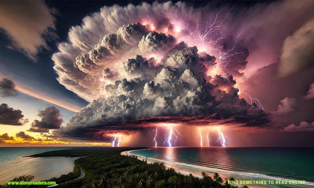
Hector is one of the most unique meteorological phenomena in the world, a massive thunderstorm that forms almost every afternoon over the Tiwi Islands in Australia's Northern Territory. This remarkable storm has been observed for decades and continues to capture the interest of meteorologists, pilots, and weather enthusiasts alike. Its near-daily formation makes it a standout feature in the region, offering a fascinating glimpse into atmospheric dynamics and tropical weather patterns.
The Tiwi Islands, located about 80 kilometers north of Darwin, consist of Bathurst and Melville Islands. These islands experience a tropical climate, with warm temperatures and high humidity levels that create the perfect conditions for thunderstorm development. Hector typically appears during the late afternoon, towering over the islands and often visible from great distances. Its consistent formation has made it an invaluable natural laboratory for studying convective storms and atmospheric interactions.
The primary reason Hector forms so regularly is the unique topography and climatic conditions of the Tiwi Islands. The islands' landmass, combined with surrounding oceanic moisture, promotes strong convection. The heat of the day warms the land significantly, causing air to rise. As it does, it interacts with moisture-laden sea breezes from multiple directions, leading to rapid condensation and thunderstorm development. The interaction of these local factors results in a powerful convective system that manifests as Hector almost daily during the warmer months.
The storm itself is characterized by massive cumulonimbus clouds, often reaching altitudes of 20 kilometers or more. Lightning, heavy rainfall, and strong winds are common features of Hector, sometimes leading to localized flooding and temporary disruptions. However, the storm is typically short-lived, dissipating as the sun sets and the surface heating decreases. Despite its intensity, it rarely causes widespread damage, as its impact is mostly confined to the islands and their immediate surroundings.
Hector is not only a subject of fascination for meteorologists but also holds historical significance. It was first documented by pilots during World War II, who used it as a navigational landmark. The storm’s predictability made it a reliable feature for aircraft operating in the region, helping them establish positional awareness. Since then, Hector has remained a focal point for weather studies, with researchers using satellite imagery, radar data, and field observations to understand its mechanisms better.
One of the most intriguing aspects of Hector is its potential implications for broader meteorological studies. Understanding the processes that lead to its consistent formation provides valuable insights into tropical convection, cloud physics, and climate interactions. Studies on Hector contribute to improved weather forecasting models, particularly for predicting severe thunderstorms and their associated risks. Furthermore, its behavior offers parallels to other convective systems around the world, helping scientists refine global climate models.
In addition to its scientific value, Hector is a spectacle for those lucky enough to witness it. Tourists and photographers often capture breathtaking images of the towering storm, with its dramatic cloud formations and frequent lightning strikes creating stunning visual displays. The Tiwi Islands' remoteness means that few people experience Hector firsthand, but those who do are treated to a unique meteorological phenomenon unlike any other.
While Hector is most prominent during the wet season, from September to April, its presence can occasionally be noted outside this period. The frequency and intensity of the storm vary depending on broader climatic conditions, such as El Niño and La Niña cycles, which influence weather patterns across northern Australia. However, its general reliability as an almost-daily event remains one of the most remarkable aspects of this natural occurrence.
Research into Hector continues, with ongoing studies aimed at understanding the finer details of its formation and behavior. With advances in meteorological technology, including high-resolution satellite monitoring and climate modeling, scientists are gaining deeper insights into how Hector fits into the larger framework of tropical weather systems. These studies not only enhance our understanding of localized weather phenomena but also contribute to the broader field of atmospheric science.
Hector’s persistence and predictability make it a truly unique feature of the Tiwi Islands. Its daily formation is a reminder of the intricate balance of atmospheric conditions that drive weather patterns. For meteorologists, it offers an excellent case study of convective storm development. For pilots, it remains a landmark in the sky. And for nature enthusiasts, it stands as a dramatic display of the power of weather. This extraordinary thunderstorm continues to be a subject of intrigue and discovery, solidifying its place as one of Australia's most fascinating weather phenomena.