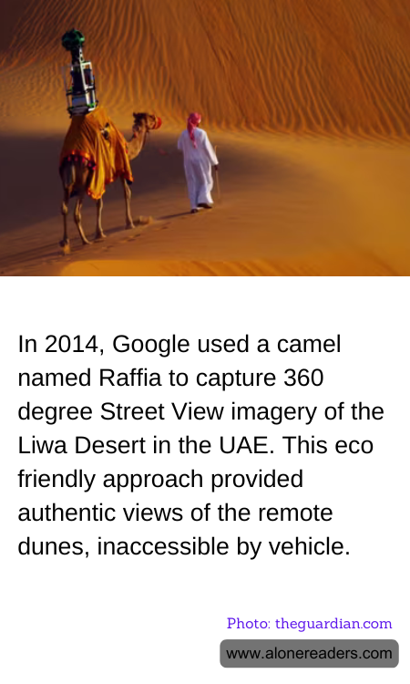
In an innovative move to map the remote dunes of the Liwa Desert in the UAE, Google in 2014 employed a rather unusual method by using a camel named Raffia to capture its 360-degree Street View imagery. This choice was not only practical but also eco-friendly, reflecting a conscientious approach towards the environment and the preservation of the natural landscape.
The Liwa Desert, with its vast and unending stretches of sand, presents a challenging terrain for traditional motorized vehicles. Google's decision to use Raffia the camel allowed the tech giant to access areas that might have otherwise been inaccessible, ensuring a minimal ecological footprint. Camels, being native to desert environments, seamlessly blend into the ecosystem without disturbing the local wildlife and flora. This method avoided the potential damage that heavy vehicles could inflict on the fragile desert ecosystem, such as soil compaction and disruption of indigenous species.
Using a camel also provided a more authentic view of the desert. The imagery captured offers viewers around the world a unique perspective of the sands and skies of Liwa, seen from the traditional mode of transport used in the region for centuries. This not only adds a layer of cultural authenticity to the imagery but also highlights the historical importance of camels in desert communities.
Google's application of innovative technology in an environmentally sensitive manner set an impressive precedent for future geographic documentation. By putting sustainability at the forefront of technological advancement, Google demonstrated that cutting-edge tools and respect for the environment can go hand in hand, providing a valuable lesson in responsible innovation. This project not only enriched Google Maps' repertoire with stunning visuals of one of the most beautiful deserts in the world but also showcased the possibilities of integrating traditional methods with modern technology to achieve remarkable results.